
Here’s a look at a mostly bygone type of instrument approach: a PAR—precision approach radar—procedure. When you fly a PAR, a specially trained controller uses a short-range, highly accurate radar display to talk you down. The controller guides you left and right to remain on the extended runway centerline while also directing you to adjust your descent to follow the proper vertical path. In effect, you fly an ILS, but instead of using localizer and glideslope indicators to help you remain on track, you follow the controller’s instructions.
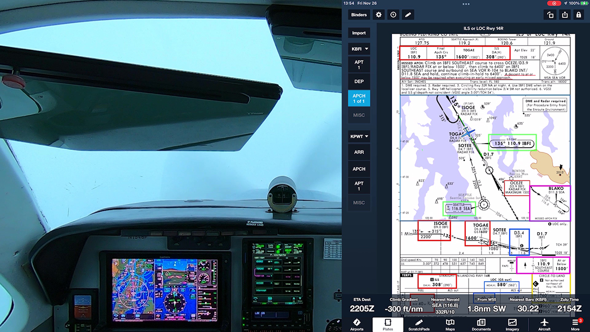
PAR were standard practice, especially at military airfields in the decades following World War II. You can see dramatized, but realistic depictions of PAR in movies, such as the conclusions of Strategic Air Command, starring Jimmy Stewart, and the first film in the Airport franchise, released in 1970.

The PAR controller in Airport (1970)
The radar displays and other electronics have been updated since, but the basic process remains the same even today. Although a PAR could be useful in an emergency, as in those films, today it’s unlikely that you’ll have a radar approach available nearby if your primary navigation equipment fails. But as I’ll explain a bit later, flying PAR approaches is still an excellent exercise.
In the U.S., only about 100 approaches with “radar minimums” remain in the system. Most of those procedures are at military bases, and the armed forces still use PAR in daily operations.

Some military facilities allow civilian aircraft to fly practice PAR approaches. The controllers need to practice guiding aircraft in, and they’re usually happy to provide the service. You just can’t touch down on the runway at the end of the approach.

In this video, I flew the PAR runway 15 at Gray Army Airfield (KGRF) near Tacoma, WA. It’s mostly home to helicopters, but it also serves fixed-wing aircraft and is part of the Joint Base Lewis-McChord complex.

There is no approach chart for a PAR. Instead, the critical details for radar procedures are shown in the “radar minimums” listings in the Terminal Procedures Publication for each region in which radar approaches are available.
Often when pilots fly a PAR, they load the corresponding ILS for the runway as backup. But for this video, I didn’t want to reference LOC and GS displays. Instead, I hoped to use the PAR to make an important point about instrument flying. As you’ll see, following the controller’s verbal commands forces you to use the control-performance method of instrument flying. You don’t have needles to chase, so you must smoothly and precisely fly specific headings while simultaneously making small pitch and power adjustments to track the correct vertical path. A PAR is a great exercise in precise aircraft control.

I did a radar approach at Youngstown OH, KYNG back during my instrument training. This is an ASR approach, so I assume the controllers will direct you to descend to a set altitude to hold for each leg. KYNG is a class D within a TRSA…TRSA is something that has always confused me. I assume there are not too many TRSA’s. Thanks for the motivation to do the ASR at KYNG again.
Check the radar minimums data. If you are descending to an MDA, it’s a non-precision, ASR approach. If the procedure offers a DA, then it’s a PAR–a precision approach with vertical guidance to a DA/DH.
Only a few TRSAs remain. Most have been converted to Class C airspace. Functionally, a TRSA is essentially like Class C, although participation is voluntary. You can read about TRSA in the AIM.
It is interesting that Whidbey NAS lists a PAR, a PAR W/O Glideslope, and an ASR approach mins. Gray lists only a PAR approach. Maybe due to the related airport TERPS or to the radar equipment. Equipment-wise, it seems like you could do a PAR W/O Glideslope if you have PAR equipment. Just interesting.
The ICAO ABC airspace monikers were introduced in the US in 1993. ICAO was not specific about what each meant, allowing each member country to develop its own design and parameters. The US had it easy, just renamed the existing airspace with some modifications. Most TRSAs became Class C. The TRSAs that remain today (30-31) don’t justify as Class C due to low traffic.
For practical purposes, TRSAs are “just like” Class C, except that participation is voluntary.
Before the ABC airspace, airspace nomenclature was:
• Terminal Control Area (TCA) – Now Class B
• Airport Traffic Area (ATA) – Now Class D
• Control Area – Sort of like Class E Aloft
• Positive Control Area – Now Class A
• Control Zone – Sort of like Class E Ground-Based
• Terminal Radar Service Area (TRSA) – 31 or 30 still exist – Most now Class C
I don’t want to quibble with the FAA stats that there are around 100 approaches with “Radar Mins.” I wonder if, within the 100 approaches, the FAA comingles PAR and ASR (Airport Survelienace Radar) approaches.
However, I assume a certain percentage of such “Radar Min” approaches are ASR approaches. ASR approaches were widespread at civilian airports using approach control radar. Also, ASR approaches use a different technology from PAR approaches.
Since the article focuses on PAR, ASR approaches are not mentioned. Unlike the FAA, Jepp does publish graphic charts for ASR approaches at civilian airports. Example: RADAR-1 at KEYW.
The inventory of IFR radar procedures includes both ASR and PAR. You have to check the TPP to determine which procedures offer PAR v. ASR. As I said, they’re aren’t many PAR left in the U.S.–as far as I know, they’re all at military bases. Of course, PAR uses different technology. As I noted, a PAR requires a special short-range, highly accurate system. ASR use normal approach control radar and offer only LNAV minimums to an MDA.
In recent memory, I have never seen a PAR at a civilian airport, only at military and some joint-use airports. PAR is also relatively portable (not so ASR), used extensively during the Berlin Airlift 1948-49.
Enjoyed this. Thanks very much.
Question: Is there a way to search for types of approach? For example if I wanted to find out where the few remaining NDB approaches are in Pennsylvania? Or if I wanted to find an LDA approach near me? I’ve played with this Aeronautical Information Services website and haven’t been able to figure it out.
Thx, Roger
I’m not aware of an easy way to produce lists of types of procedures.
Here’s an idea that might get you close. You can use a database query at eNASR Browser (https://enasr.faa.gov/eNASR/nasr/). You could, for example, find all the NDBs in PA. The query won’t show approaches based on NDBs (at least as far as I can tell), but it would help you then look for airports and charts associated with each navaid in the results. My query shows 17 NDBs in PA. The database shows no LDA facilities in PA.
Well that was interesting. Never seen that website before. Those two examples I mentioned were just out of thin air.
I’m also curious to be able to search by mins…e.g. all the LPV mins in an area, or circling, or LNAV/VNAV. DME arcs would be interesting too.
As a CFII, this could be useful info.
That’s the only database I know of for public use.